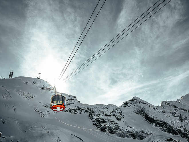
Hiking trails
Hiking with far-reaching view, breathing in fresh alpine air, giving your circulation new wellbeing, breathing in the scents of flowers, giving your senses new experiences: Over 500km of hiking trails invite to be discovered.
Schmugglis Sbrinz Route

Engelberg-Titlis Tourismus Verified partner
 Schmugglis Sbrinz Weg_1Photo: Engelberg - Titlis Tourismus, Engelberg-Titlis Tourismus
Explanation
The historic Sbrinz Route leads from Lucerne via Engelberg to Domodossola. This is where the popular Sbrinz cheese used to be brought and exchanged for olive oil, red wine and other Italian goods. Smuggler Engelbert and his mule Schmuggli try to solve six tricky riddles between Lake Trübsee and the alp Untertrübsee and remain undetected by customs officers and witches. Follow them, solve the tasks and try to find the right solution word. You can win attractive prizes.
The Schmugglis adventure world on Trübsee, which is very popular with families, has one more attraction. A new puzzle trail - Schmuggli's Sbrinz Trail - is being created on the mountain hiking trail from the Hüethütte to the Untertrübsee alpine cheese dairy. On the 1.5-hour hike, visitors become cheese smugglers themselves and have to secretly bring their wheel of cheese on the right path at various skill, game and rest stations - without getting caught. Only those who are clever enough and have successfully completed a game station receive a letter and can move on with their smuggled goods. At the very end of the route, all the letters add up to a solution word that visitors have to figure out.
To solve the riddles at the six stations, you need a wooden token. You can buy one for CHF 5 at the cash desk at the Titlis valley station or in the self-service restaurant of the Berghotel Trübsee. You can then take it home as a souvenir.
Author’s recommendation
In keeping with the "Schmuggli" theme, a visit to the Schmugglis Camp or playground on Lake Trübsee is worthwhile as a family. An exciting treasure hunt can be completed around Lake Trübsee. A visit to the Schmugglis adventure world is always worthwhile.

Derived from the technical difficulty and the stamina requirements.
Track types
Rest stops
Berghotel TrübseeSafety information
- Der Spielplatz ist während den Betriebszeiten der Titlis Bergbahnen geöffnet (aktuelle Informaiton unter offenen Anlagen).
- Benutzug des Spielplatzes auf eigene Gefahr. Eltern sind verpflichtet, ihre Kinder immer zu beaufsichtigen und hafen für sie.
- Kein Helm und keine Gegenstände um den Hals tragen.
- Besondere Aufmerksamkeit gilt beim Spielen in der Nähe von Wasser.
- Mängel bitte umgehend dem Bahnpersonal der Titlis Bergbahnen melden.
Im Notfall SOS Titlis Bergbahnen
+41 (0)41 639 50 61 oder 144 alarmieren
Tips and suggestions
Weitere Informationen zum Schmuggli Sbrinz Weg findest Du unter dem folgenden Link: www.titlis.ch/sbrinz
Empfohlenes Alter:
6 - 14 Jahre
Kinderwagen:
Schmugglis Sbrinz Weg befindet sich auf einem Bergwanderweg und ist für Kinderwagen nicht geeignet.
Grillstellen:
Auf Schmugglis Sbrinz Weg gibt es keine Grillstellen. Beim Posten «Zöllner-Unterstand» hat es jedoch Sitzgelegenheiten für ein Picknick.
Toiletten:
Bei der Älplerseil Bergstation befindet sich ein umweltfreundliches Kompotoi.
Kosten:
Um die Rätsel bei den sechs Stationen zu lösen, brauchst du einen Holztaler. Der Holztaler kostet CHF 5. Zusätzlich benötigst du ein Bahnticket Engelberg-Trübsee. Kinder mit Juniorkarte fahren in Begleitung eines Elternteils gratis mit der Bahn.
Abkürzung:
Wenn du nicht den ganzen Weg zu Fuss gehen willst, kannst du mit der Luftseilbahn Älplerseil bis nach Untertrübsee fahren. Dort erhältst du beim Wegweiser mit der Milchkanne die richtigen Symbole von den Posten 4 und 5. Folge dann dem Wegweiser zu Posten 6.
Turn-by-turn directions
Public transport
Nationale und internationale Verbindungen (ab Zürich Flughafen Verbindungen im Halbstundentakt mit ca. 1h Fahrzeit) bis Luzern. Danach mit der Zentralbahn in 43 Minuten durch eine abwechslungsreiche Landschaft und Schluchten hinauf nach Engelberg.Directions
Mit dem Auto fahren Sie auf der A2 (Basel-Gotthard) bis Stans Süd, dann auf der Hauptstrasse 20 km nach Engelberg. Engelberg liegt 30 Minuten von Luzern, 1 Stunde und 15 Minuten von Basel, Zürich oder Bern.Parking
Parkplätze stehen in Engelberg kostenpflichtig zur Verfügung: Weitere InformationenCoordinates
Derived from the technical difficulty and the stamina requirements.