Hiking trails
Hiking with far-reaching view, breathing in fresh alpine air, giving your circulation new wellbeing, breathing in the scents of flowers, giving your senses new experiences: Over 500km of hiking trails invite to be discovered.
Dwarf path Bannalp
Nature Trail · Central Switzerland

Responsible for this content
Engelberg-Titlis Tourismus Verified partner
Engelberg-Titlis Tourismus Verified partner
 Photo: Engelberg - Titlis Tourismus, Engelberg-Titlis Tourismus
Hint
Explanation
Selected alternatives for you
The secret of the sparkling stone.
easy
Distance 2.7 km
0:49 h
42 m
133 m
1,718 m
1,587 m
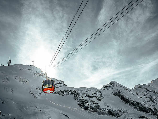
It was around noon, and the sun shone brightly over the dwarf village in the mountains. The children were playing and laughing like every day at this time. Pina and her friends Timo, Rick and Lolo played hide and seek near the old oak tree. "What is this?" Timo shouted and pointed to a red shimmering under the moss. Experience the story about the secret of the sparkling stone. The story begins at the top station of this cable car and takes you to different places on Bannalp. Enjoy this enchanting children's hiking trail in a breathtaking mountain landscape. Lunch on the way is no problem. The Zwärgliweg leads past the fireplaces directly at the Bannalpsee. At the mouth of the mountain stream into the Bannalpsee there is a wood supply for the barbecue sites. Ask at the cash desk for the cheap family tickets. We wish you lots of excitement and a relaxing time at Bannalp.
Author’s recommendation
The Dwarf path Bannalp is a hiking trail for children with 7 stations. At each station there is something to discover or marvel at.
The matching book with CD can be bought at the ticket office of the cable car Fell-Chrüzhütte, Bannalp.

Author
Engelberg - Titlis Tourismus Update: September 30, 2020
Difficulty
easy
Overall difficulty
easy
Derived from the technical difficulty and the stamina requirements.
Experience
Landscape
Highest point
1,718 m
Lowest point
1,587 m
Best time of year
Jan
Feb
Mar
Apr
May
Jun
Jul
Aug
Sep
Oct
Nov
Dec
Track types
Show elevation profileSafety information
Since the entire Dwarf path leads along natural paths, we do not recommend using a baby carriage.Tips and suggestions
The story was realized by the Oberrickenbach Comprehensive School and has been made available to the Bannalp region free of charge for a Dwarf path.Rest stop
Nearby
Top Partner
Waypoint
Start point
End point
Low point
High point
Forecast
Public transport
Diese Wanderung befindet sich im Gebiet Bannalp. Das Gebiet Wolfenschiessen-Bannalp erreichen Sie in ca. 15-20 Minuten per Auto oder mit dem öffentlichen Verkehr ab Engelberg.Directions
Diese Wanderung befindet sich im Gebiet Bannalp. Das Gebiet Wolfenschiessen-Bannalp erreichen Sie in ca. 15-20 Minuten per Auto oder mit dem öffentlichen Verkehr ab Engelberg.Coordinates
SwissGrid
2'676'004E 1'191'658N
DD
46.871704, 8.435580
DMS
46°52'18.1"N 8°26'08.1"E
UTM
32T 456987 5191061
w3w
///fixed.nowadays.plankton
Get there by train, car, bike, or on foot!
Difficulty
easy
Overall difficulty
easy
Derived from the technical difficulty and the stamina requirements.
Distance
2.7 km
Duration
0:49 h
Ascent
42 m
Descent
133 m
Highest point
1,718 m
Lowest point
1,587 m
Weather at the route's trailhead
Statistics
Maps and trails
Nothing selected - click and drag in the elevation profile to zoom
Distance
Duration
Ascent
Descent